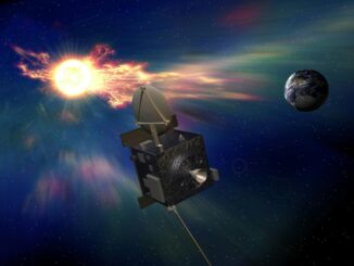
Satellite imagery has reshaped from a closed resource for certain sectors into an open, dynamic ecosystem. What was once exclusive to intelligence agencies now underpins everyday uses — from crop health monitoring to validating insurance claims.
At the center of this change are state-of-the-art, AI-powered tools such as a GIS platform for real-time satellite images. These tools have cut the image processing time from weeks to minutes, broadening the industrial uses of space-derived data. As satellite operators multiply and public-private partnerships flourish, this dynamic market is set to expand quickly — changing old and unlocking new uses for space images.
Satellite Imagery Market: Actual Size And Trajectory
The satellite imaging market is on an impressive growth trajectory, projected to nearly double by 2034 from its current evaluation of $3.31 billion. This surge reflects the increasing need for fast and ground-truth data in domains like agriculture, city building, and logistics. As artificial intelligence (AI) technology becomes more integrated, it is refining image analysis, making satellite insights more accessible and applicable for both business and science.
Integrating AI In The Satellite Imaging Market
AI systems are enhancing the speed and depth of space-based research, meeting growing corporate needs for data-driven decisions. These systems process vast image collections rapidly, identifying subtle changes and anomalies human analysts might miss. AI models improve with each training, becoming smarter over time.
Geographic information systems (GIS) complement artificial intelligence by enabling spatial analysis to find patterns, measure feature density, examine specific areas, and track landscape evolution. This technological pairing creates a more practical, detailed vision from satellite imagery than was previously feasible.
Key Applications Of Space-Derived Images
Space imagery isn’t just about capturing distant landscapes; it’s about revealing hidden patterns to drive smarter real-world decisions. With this new perspective, they are helping industries from defense to insurance act proactively and sustainably.
Defense And Security
The power to observe sensitive or restricted locations in real time and across various wavelengths opens up these employments:
- Intelligence and sensitive zone observation. The live satellite view allows surveillance of borders and sensitive zones to detect suspicious activities and threats.
- Military mission arrangement and emergency response. Space-derived photos provide commanders with comprehensive battlefield views and help rescue teams assess damage and coordinate relief efforts efficiently.
Farming And Environmental Survey
Surveying large regions and identifying subtle, emerging trends proves invaluable for:
- Precision farming and crop health assessment. Early warning signs of crop stress emerge clearly in current multispectral satellite imagery, empowering targeted interventions and optimizing resource management.
- Deforestation tracking, carbon credit verification, and climate change studies. Orbital sensors can easily track illegal deforestation activities, support carbon credit validation, and document shifting climate patterns.
City And Infrastructure Development
Observing territories from multiple angles and within various structural contexts works perfectly for:
- Keeping tabs on land-use changes and city development. A wealth of orbital data reveals urban expansion patterns, transportation bottlenecks, and opportunities to reduce the negative footprint.
Assessing the aftermath for rebuilding efforts. Up-to-date satellite images guide reconstruction efforts by pinpointing damaged buildings, structures, and roads.

Disaster Mitigation And Response
Satellites’ ability for instant data capture and surveying areas that are hard/impossible to access physically are critical for:
- Real-time tracking of wildfires, floods, storms, and earthquakes. Satellites pierce through smoke and clouds to track catastrophe boundaries, predict spread patterns, and identify at-risk neighborhoods.
- Humanitarian aid planning and response coordination. Satellite-derived crisis mapping guides teams through accessible routes while optimizing resource distribution across damaged landscapes.
Other Business Applications
With its cost efficiency and broad coverage, satellite data is a powerful tool in numerous commercial sectors, including:
- Real estate and insurance. Businesses use the most recent satellite images to evaluate properties, assess risks, track urban expansion, and make informed investment decisions without physical inspections.
- Logistics and supply chain optimization. Companies identify ideal warehouse locations, plan resilient delivery routes, and observe global shipping patterns in real time.
As space imaging and AI-driven analytics advance, satellite data applications extend far beyond today’s.
Key Drivers Of Satellite Imaging Market Expansion
The satellite imagery market continues to expand due to numerous industry drivers, such as:
- growing need for precision mapping data in farming, logistics, and city planning;
- corporate demand for higher-quality images delivered faster;
- public-sector funding in narrow-purpose satellite systems;
- uses in the defense sector requiring real-time satellite view;
- climate and ecosystem tracking to back climate policy development;
- e-commerce businesses needing systems and route optimization.
These factors combine to make satellite imaging not just a growing trend but a go-to instrument for solving today’s biggest challenges.
Prospects Of Satellite Imaging Market
The true power of space-derived imagery is in the way it’s changing for better how industries predict, plan, and respond. AI-driven tools turn raw data into actionable knowledge, closing the gap between simple and decisions. As the technologies continue to evolve, space imagery is set to become an even more indispensable asset for businesses worldwide.